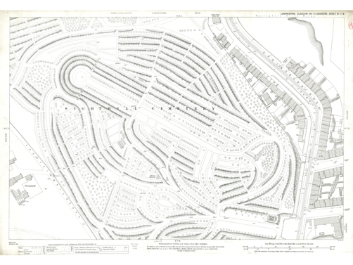
The latest addition to our Glasgow Town Plan map series is sheet VI.7.8 showing Sighthill Cemetery. At around 400ft above sea level its name derived from the views of Glasgow and its surroundings it afforded in all directions.

Sheet VI.7.8 of the 2nd edition town plan of Glasgow showing Sighthill Cemetery. Click the image to view a zoomable version of this map.
The 46 acre site of the cemetery was purchased by a joint stock company in 1840, with the first burial taking place on the 24th April that year. Initially only 12 acres were used for burial purposes, with the graves located by distance and compass bearing from a central point. This rather complicated and eccentric method did not last long however, and by the time of the revised survey in 1893 the more traditional layout we see today was in place.
Sighthill Cemetery was not affiliated with any particular religion and mainly catered to the middle class rather than the wealthy citizens of Glasgow. As a result there are fewer grand tombs and monuments than the Necropolis, with the most notable of those present at Sighthill Cemetery being the Martyr’s Memorial.
The zoomable version of this map can be viewed by clicking the image above or by clicking here. If you have any questions about this map, or any other maps held by the University Library, feel free to contact the Maps, Official Publications and Statistics Unit.
Other entries in the series:
Pollockshields Town Houses and Villas
Queen Street Station and George Square
Categories: Library, Official Publications
 Miners, AI, and wind turbines : New Official Publications 07.05.24
  Fiscal Drag, Vaping, and the United Kingdom – New Official Publications 17.04.24
Leave a comment